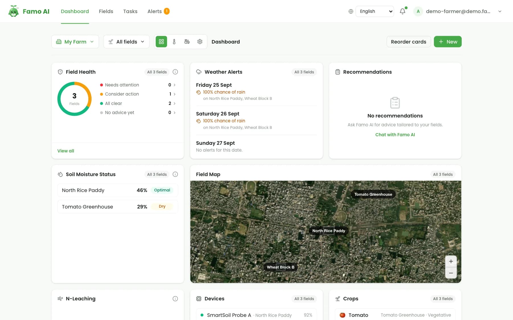
A farmer opens Famo AI in the morning and sees three things: which field needs attention, why, and exactly what to do. Behind that short list is a pipeline that combines several kinds of data. This article walks through it, step by step.
The loop: measure, understand, act, improve
Famo works in a four-step loop that repeats every day of the season:
- Measure — collect what is happening on the farm.
- Understand — combine it with the crop, the stage and the weather.
- Act — turn it into clear tasks, plans and doses.
- Improve — record what happened and learn from it next time.
Step 1: Measure
Famo uses every source of information a farm has, and works with as few or as many as are available.
Soil readings. The SmartSoil 8-in-1 sensor measures pH, nitrogen, phosphorus, potassium, moisture, salinity (EC) and temperature in seconds. Readings can be taken by hand with the app, or reported automatically by soil probes connected to a gateway. Famo also guides good sampling: several spots per field, the same depth each time, and a few seconds for the reading to settle.
Satellite imagery. Every field drawn on the Famo map is monitored with free Sentinel-2 optical and Sentinel-1 radar imagery, refreshed every few days. From it Famo calculates vegetation indices such as NDVI, NDRE and NDWI — more than 30 in total — and finds the parts of a field that are under stress. Radar sees through cloud, which matters in monsoon seasons.
Weather. For each field Famo pulls today's conditions, the next 24 hours and a 7-day forecast, including rain, wind and reference evapotranspiration (ET₀), plus a live rain radar.
Photos. A farmer who sees something wrong photographs the leaf or stem; Famo's crop-health scan identifies the likely disease or pest.
Devices. On farms with a Famo Open Field or Famo Controlled Field package, weather stations, leaf-wetness sensors, pest-trap cameras, climate sensors and irrigation controllers report around the clock.
Step 2: Understand
Raw numbers are not advice. A soil pH of 5.9 is fine for one crop and a problem for another; 40% soil moisture is plenty before rain and too little before a heatwave. Famo's job is to put each signal in context:
- The crop and its stage. Famo keeps a stage-by-stage plan for 25 crops — from rice, wheat and maize to tomato, mango and cotton — with the targets each stage needs.
- The field's own history. Soil readings, satellite scenes and scans are compared with that field's earlier records, not just with a textbook.
- The forecast. Irrigation, spraying and fertilising advice takes the coming rain, wind and heat into account.
- Local agronomy. Plans use the varieties, seasons and practices of the farmer's region.
When something does not fit — a stressed patch in the satellite image, a nutrient below target, a scan showing early blight — Famo raises it as an alert with a level of urgency.
Step 3: Act
This is where Famo is different from a dashboard of charts. Everything it understands becomes something to do:
- Daily tasks. A short, prioritised list per field: irrigate this block, scout that corner, apply this dose. Tasks can be marked done, snoozed or skipped, and a task completed in the field updates the dashboard.
- Fertiliser plans. Based on the soil reading and the crop's needs, Famo writes a fertiliser plan with product, dose, timing and method — with organic options.
- Irrigation schedules. Weather-aware watering plans with volumes, including alternate wetting and drying for rice to save water.
- Pest and disease plans. After a scan, a dosage-by-dosage treatment plan, with organic and conventional choices.
And because Famo is voice-first, a farmer can simply ask: "What should I do on the north field today?" — in Bangla, Urdu, Punjabi, Arabic, Portuguese, Hindi or any of Famo's 12 languages — and hear the answer.
Step 4: Improve
Every reading, task and harvest is recorded. Over the season the farmer can see soil trends against targets, satellite health over time and the effect of what was done. Season after season, this record makes each recommendation more specific to that farm. For cooperatives and organisations, the same records — shared only with the farmer's consent — show where support is needed across a whole network.
What runs where
| Part of Famo | Where it lives |
|---|---|
| Soil readings, scans, voice questions | The Famo mobile app (works offline, syncs later) |
| Field maps, satellite reports, weather, soil trends, planning | The farmer web dashboard |
| Member farms, network alerts, shared land, exports | The organisation dashboard |
| Live sensors, gateways, valves, controllers | Connected devices from the Famo farm packages |
Does Famo work without the sensor or any hardware?
Yes. Satellite monitoring, weather, daily tasks, the AI advisor and disease detection all work with nothing more than a smartphone and fields drawn on the map. The 8-in-1 sensor and the farm packages add precision and automation when a farm is ready for them.
See the loop for yourself
The fastest way to understand the loop is to watch it run. The live demo opens a sample farm with fields, satellite history, soil readings, tasks and alerts — no sign-up needed. To start on your own farm, download Famo AI on Google Play or read what Famo AI is for the bigger picture.